
Read the island in layers
Map, cross-section, and 3D hypocenter views show where quakes cluster beneath Hawaiʻi Island instead of flattening them into a list.
Your real-time iPhone/iPad dashboard view into the 3 active volcanoes, Kīlauea, Mauna Loa, Hualālai and the extinct volcano Mauna Kea.
Live island wide HVO cams, alerts, maps and seismic ways to visualize earthquakes on the go.
Explore recent quakes by depth, region and history in map, list and 3D views for people of all ages that want to learn more about Hawaiʻi.
Hawaiʻi Volcanoes & Earthquakes for iPhone/iPad turns Hawaiʻi Island into a pocket-sized living dashboard. Follow Kīlauea, Mauna Loa, Hualālai, Maunakea, and Kamaʻehuakanaloa with live quake data, depth, history, observatory cams, alerts, and 3D views that reveal what is happening above the island and deep below it.
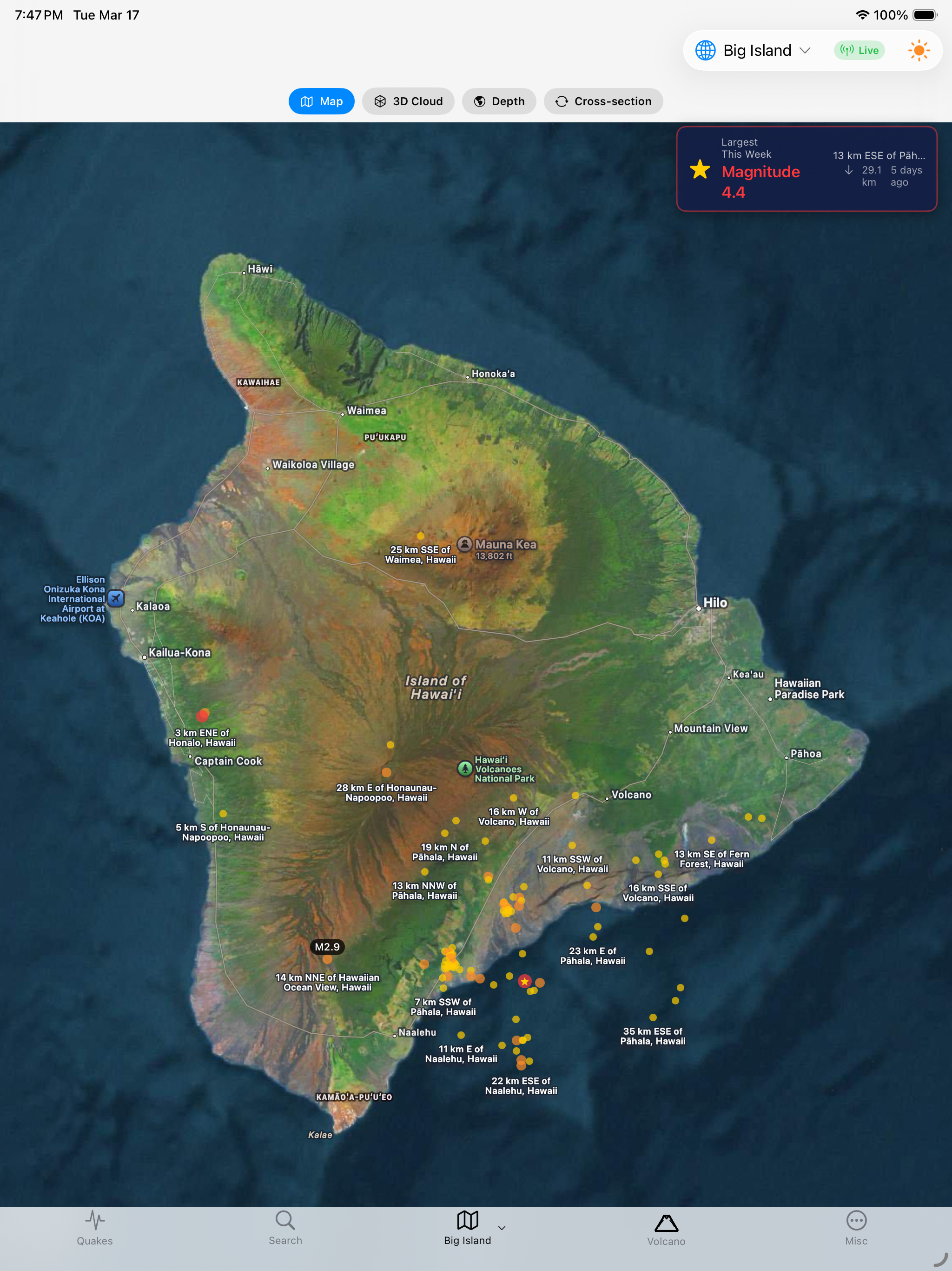
Quakes, volcano cams, activity context, and alerting come together in one fast visual tool.
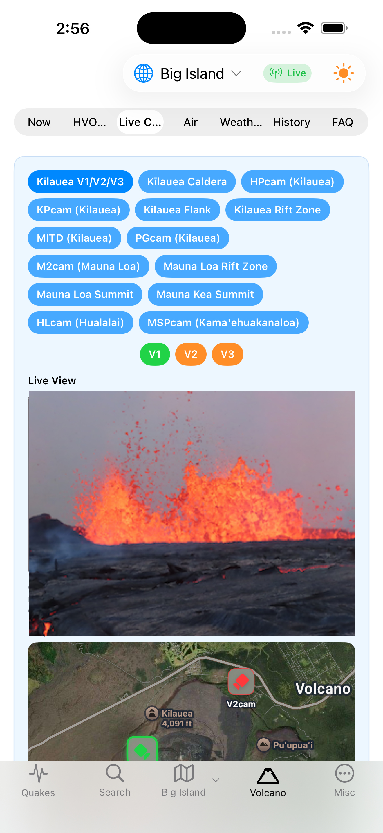

Map, cross-section, and 3D hypocenter views show where quakes cluster beneath Hawaiʻi Island instead of flattening them into a list.
HVO cameras, activity summaries, weather, tilt context, and dashboards help turn fast-changing Kīlauea and Mauna Loa conditions into something you can scan.
Alerts for magnitude, depth, swarms, lava activity, and proximity give residents, visitors, teachers, and researchers practical awareness without doom-scrolling.
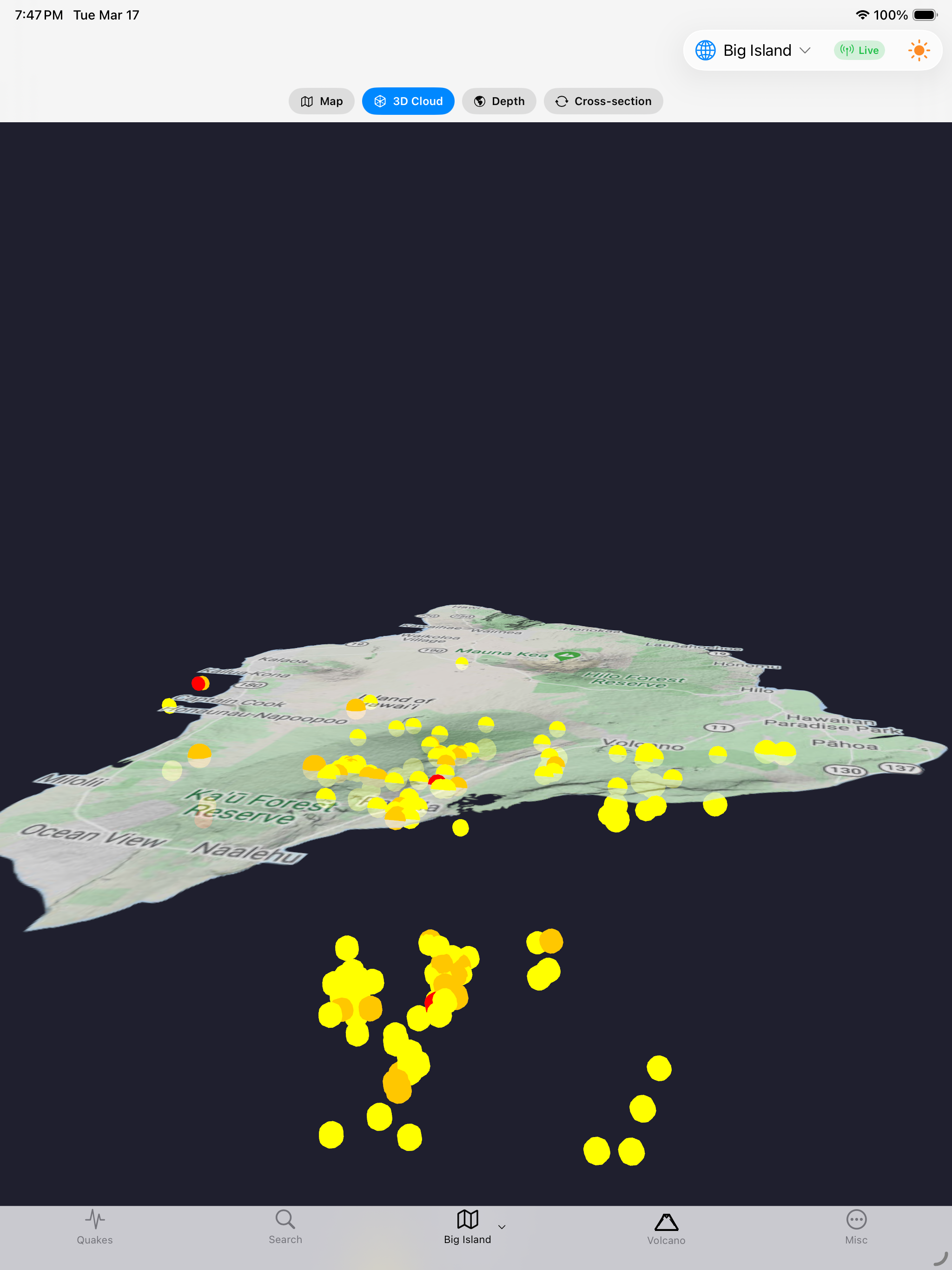
Earthquakes are easier to understand when you can see how they stack beneath Hawaiʻi instead of reading them as isolated entries in a list. This app makes the island legible with a map view, cross-sections, and a rotating 3D point cloud that reveals the deeper geometry of swarms, rift activity, and offshore clusters.
It is built for the people who keep asking better questions: Where is activity concentrating? How deep is it? What changed in the last 24 hours? How does one area compare with another?
This is not just for geologists. It is for island life, field curiosity, education, and anyone who wants more context than generic earthquake alerts provide.
Use the app as a living local dashboard before hiking, visiting Volcano, teaching geology, photographing changing landscapes, or simply keeping an eye on what the island is doing now.
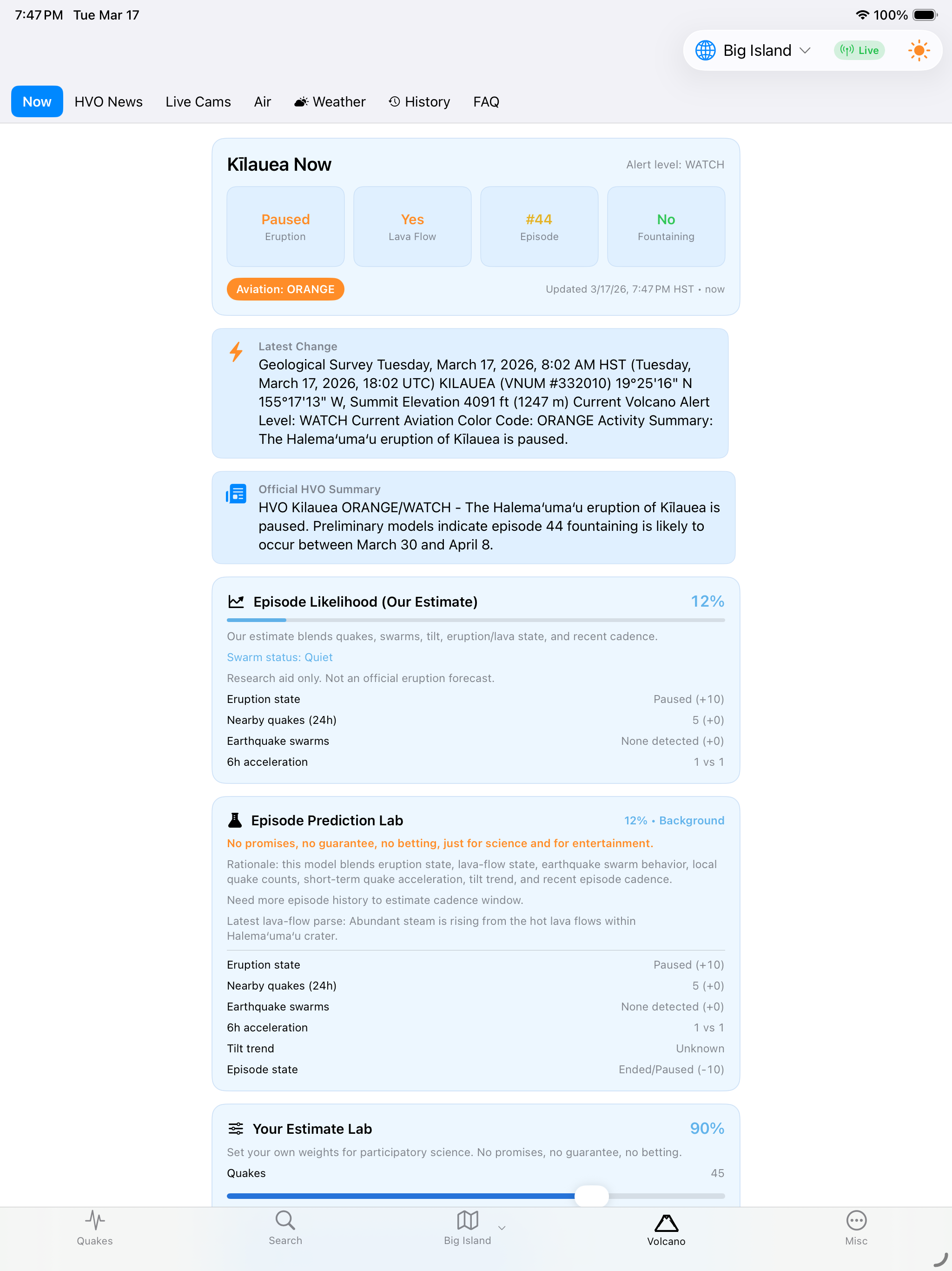
See eruption status, lava-flow context, live observatory notes, and quick-read activity summaries in one place.
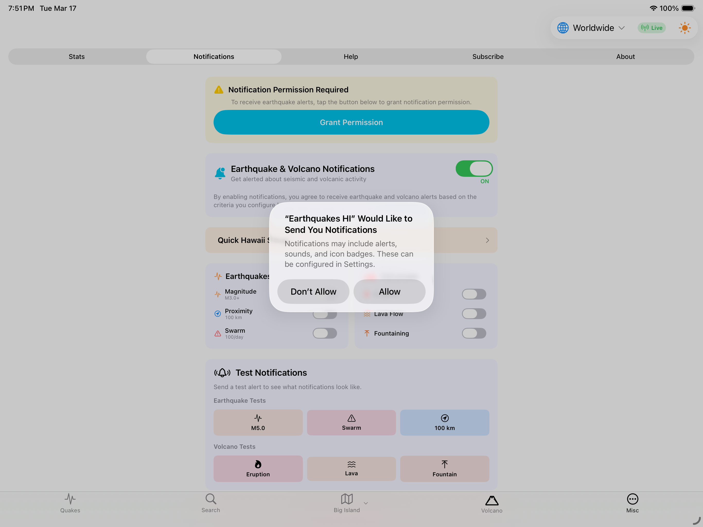
Configure notifications for magnitude, depth, proximity, swarms, lava activity, and other changing conditions.
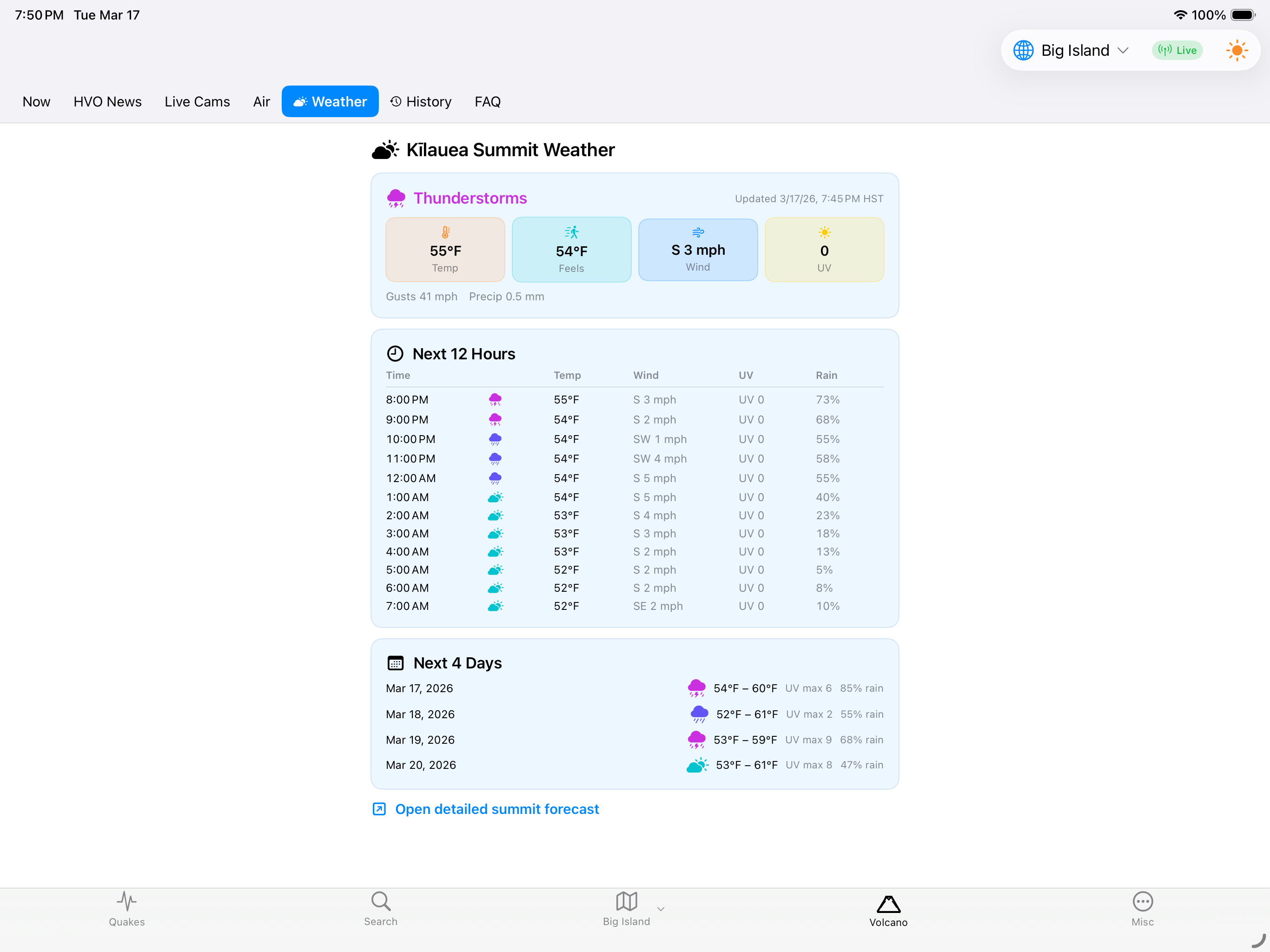
Pair seismic context with weather and volcano views so planning a visit feels grounded in real conditions.
Hawaiʻi Volcanoes & Earthquakes for iPhone/iPad is a practical island companion, a research viewer, and a visual answer to the question almost everyone asks sooner or later: what is happening under Hawaiʻi right now?
Use the App Store badge below the phone preview to get the iPhone/iPad version. The app is built for a quick island read wherever you are.
Essential tool for research, education, travel, field curiosity, and background knowledge about one of the most active volcanic regions on Earth.
User reviews coming soon.
No tutorials available for this app.
Select your platform and app to view the complete manual in a new window.
No previous versions available for this app.